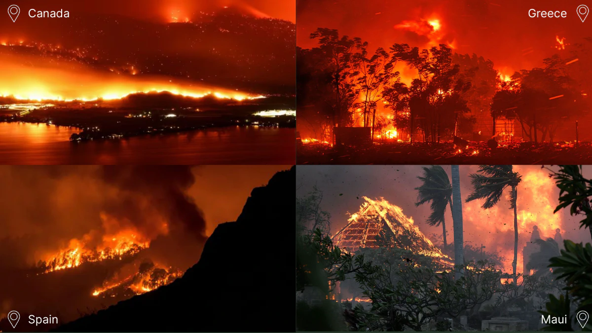
During the summer of 2023, the northeast had a wake up call. Widespread wildfires in Canada and California degraded the air quality to harmful levels. Stepping outside, you were assaulted with the smell of burning trees and a deep orange sky. That is the day that most of us realized that climate change wasn’t a distant future. It is happening today. And nobody is safe.
Hack4Delta was established to spark the Connecticut hacking scene. It is an annual hackathon geared toward developing solutions to climate change and sustainability.
With a team of my friends from the University of Connecticut, we won second place for Firefly.
Project background
The types of projects that really capture my imagination are ones that are opportunistic: making use of a pre-exising resource in a way that was never considered before. More succinctly, you can think of it as smart piggybacking.
For instance, the Laser Interferometer Gravitational Observatory (LIGO) has miles upon miles of high precision detector equipment dedicated to detecting graviational waves from black hole mergers. It accomplishes the job. However a new scientific experiment known as NANOGrav does away with the dedicated detectors and instead uses clever measurement of pulsar timings. You can learn more about it in this video I made.
Another great example is a recent feature by Google maps to route people along the most fuel effcient path. The feature was calculated to have been equivalent to taking of 250,000 cars off the road, just by changing how the GPS navigates people.
A personal favorite of mine is Ecosia, which is a search engine that plants trees with ad revenue. I’ve been using it for the past 3 years and I have planted between 50 and 100 trees at no cost to me (it’s hard to estimate since they only recently started tracking across accounts). I highly recommend this service. They do terrific boots on the ground work.
What’s cool about an idea like this is that virtually no extra resources need to be allocated. These solutions are low hanging fruit, but we need to take advantage of everything if we want to address climate change.
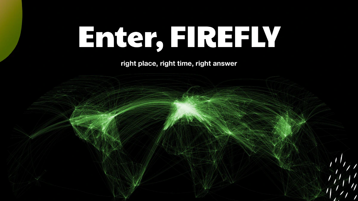
Firefly
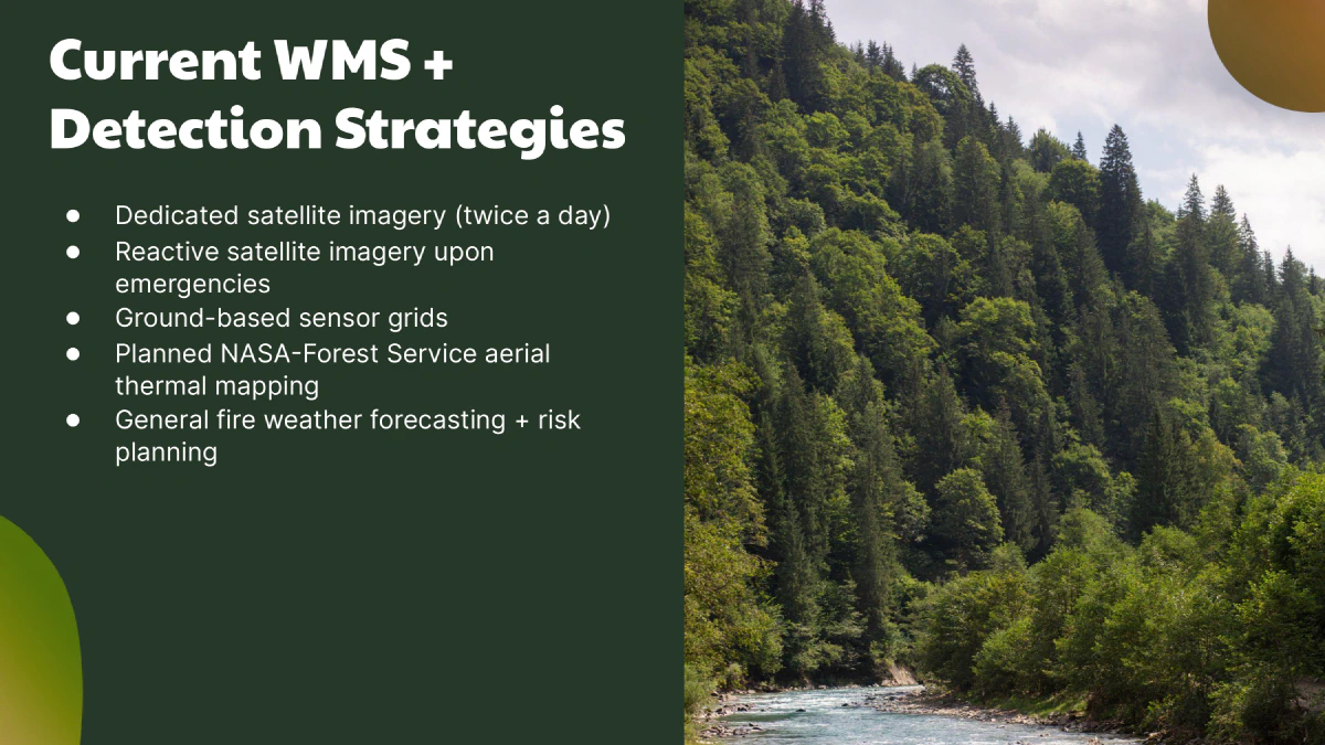
The most common methods of detecting wildfires are through satelites and forest cameras. However new methods include distributed sensing networks and AI powered cameras that can detect smoke on video. However, all of these solutions have significant drawbacks.
Satelites are capable of detecting wildfires across large swaths of the United States. However, their spatial and temporal resolution can be quite low, on average 6-24 hours between updates and a resolution of half a kilometer (source).
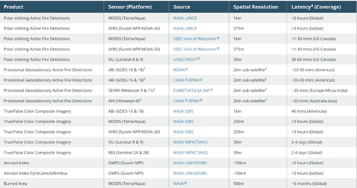
Forest cameras are ineffective when there is low visibility and can have false positives during overcast weather. Finally, sensor networks are difficult to deploy and can give false readings as they depend on air currents transmitting smoke.
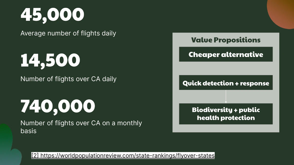
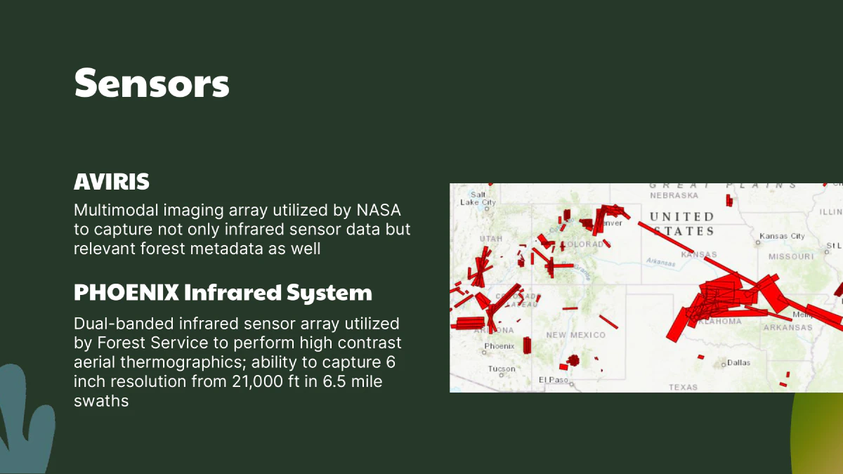
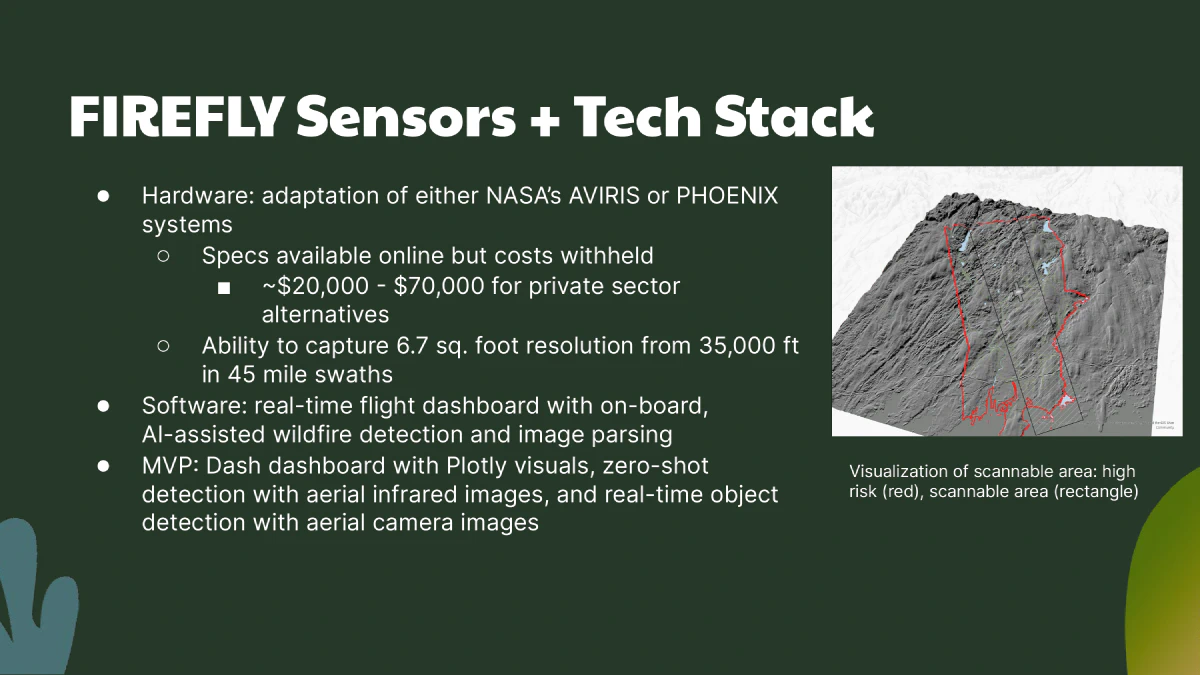
Some startups are using drones to try and detect forest fires, but the trouble of that it requires tons of new manufacturing to get any sizeable coverage of the United States. Our idea was to take advantage of the 45,000 pre-existing daily flights across the United States. By attaching high resolution infrared cameras, we should have a much higher resolution and (hopefully) much faster response times in wildfire detection.
Specifications
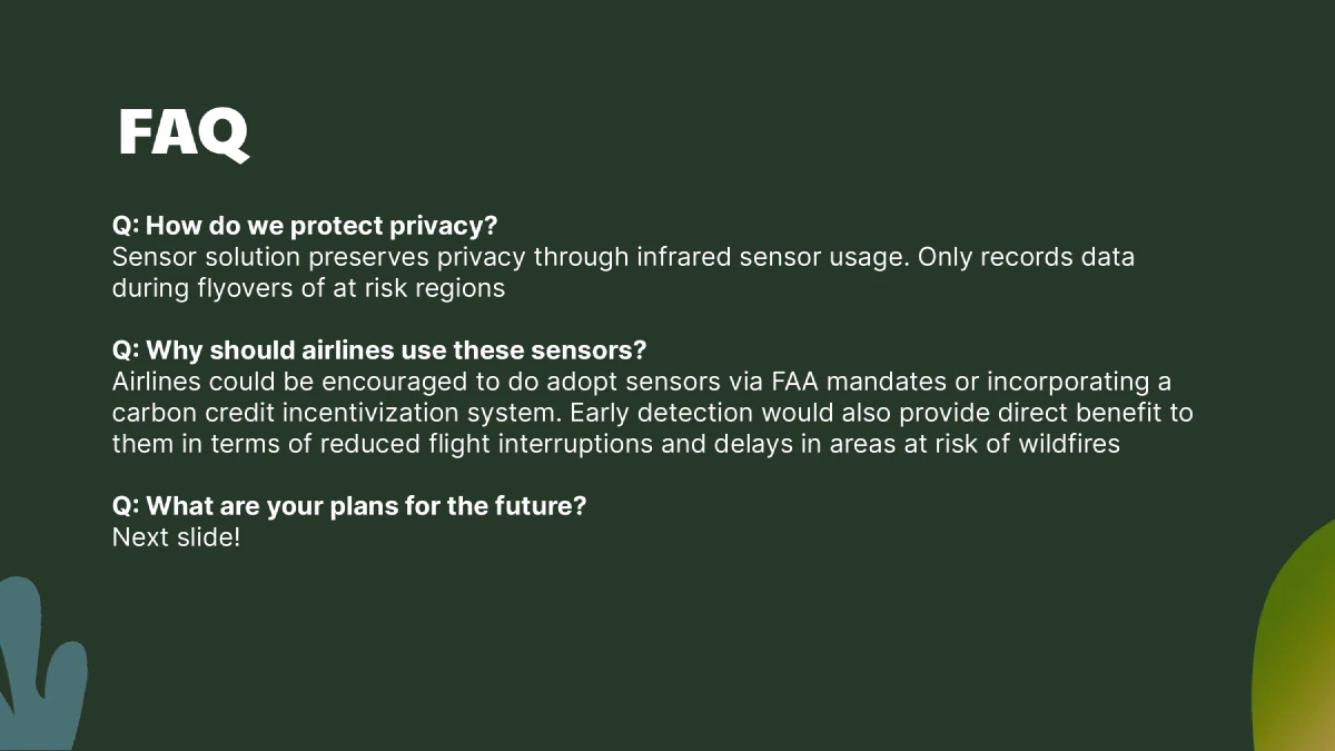
The infrared sensors in question, at 30,000 feet, are capable of scanning 45.3 miles at a time with a resolution of 1 pixel per 5x5 meter area. The infrared spectrum isn’t affected significantly by cloud cover and would be able to have readings at all times. The resolution is low enough to not significantly infringe upon privacy while still providing value.
-
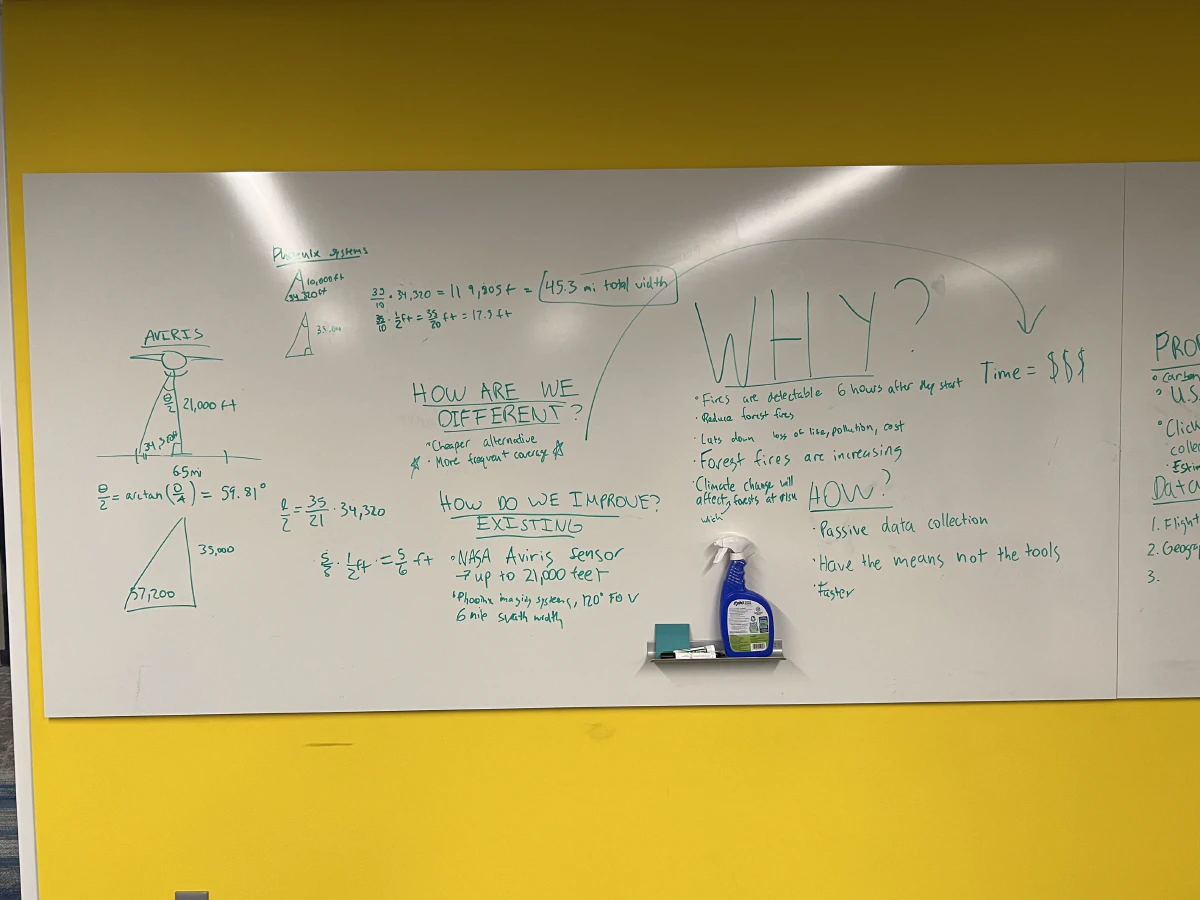
Napkin calculations -
Project discussion -
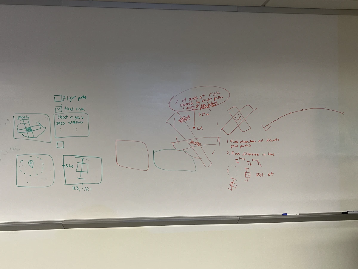
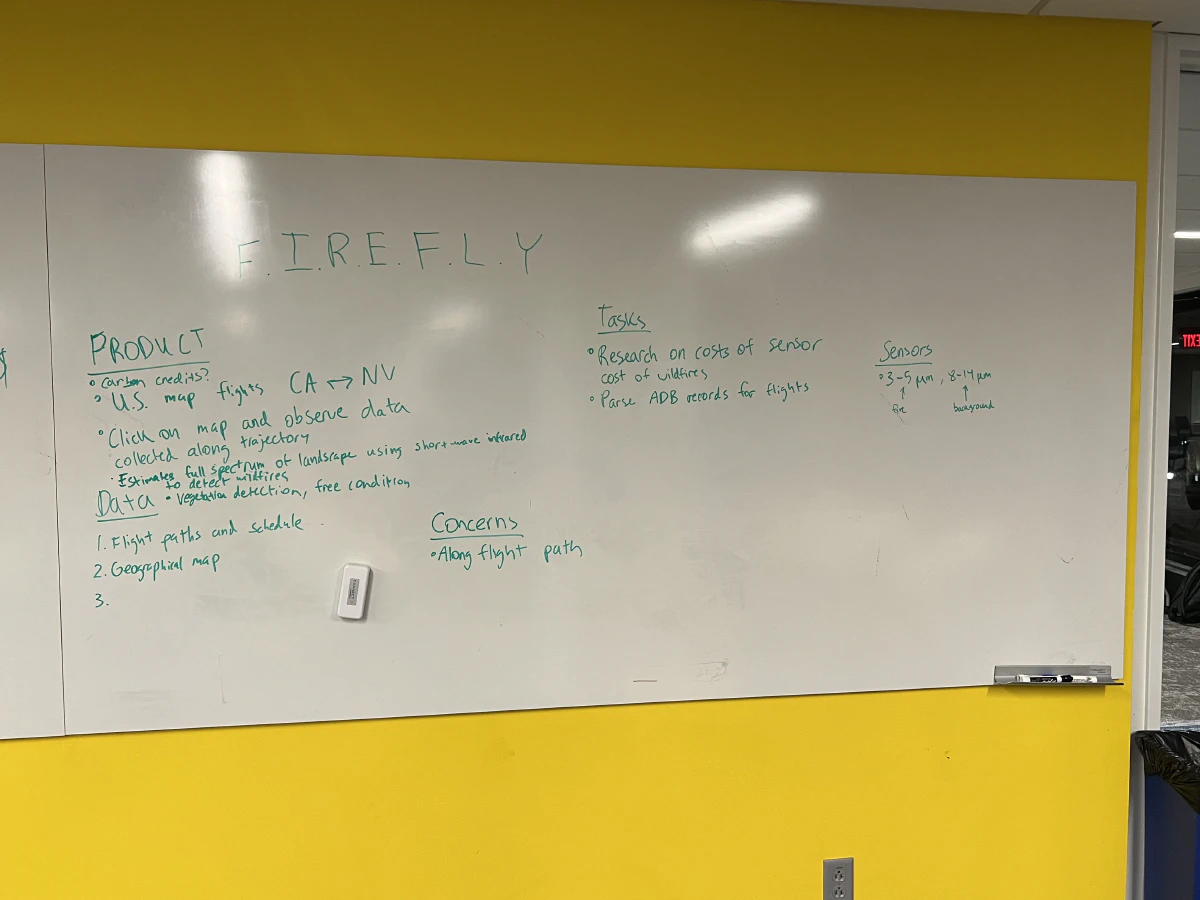
Data visualization ideas
The temporal resolution is an estimate we have not been able to formulate yet as it depends on processing massive amounts of historical flight data. This will ultimately dictate whether our idea has any merit.
Preliminary results
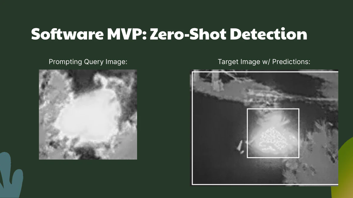
Since the hackathon wanted some kind of software product, we developed a dashboard which would give an interactive flight path visualization alongside the at risk counties in California. At the moment I don’t have our demo page running, but here’s a plot that gets the point across.
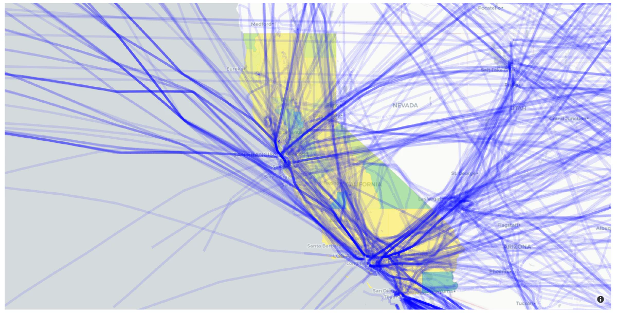
The paths are only a small subset of the flights during a single day since our dashboard couldn’t handle more than a few thousand paths at a time. Even though the plot isn’t very accurate, it does seem to be promising in terms of coverage of the state.
Long term vision and cost benefit analysis
My long term vision for this project is to develop a global Firefly network capable of rapidly identifying wildfires and dispatching drones to stop wildfires in their tracks. It is much easier to fight a fire thats a few square meters than a blaze thats out of control.
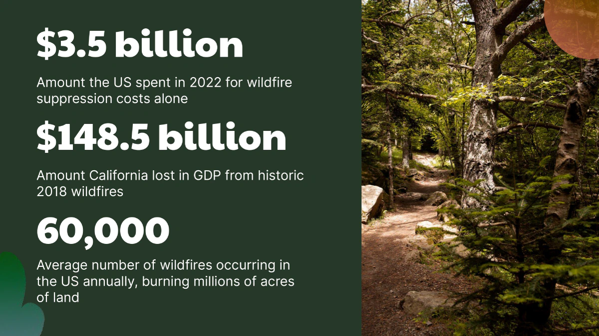
We did some back of the napkin calculations. For about $3 billion dollars we could equip almost every commercial airliner in the United States with one of these sensors (though every plane need not have a sensor, which would reduce cost). This isn’t too far off from the cost of a satelite launch. While this is expensive, in the grand scheme of things, this real time network of infrared detecting flights could bring hundreds of billions in value.
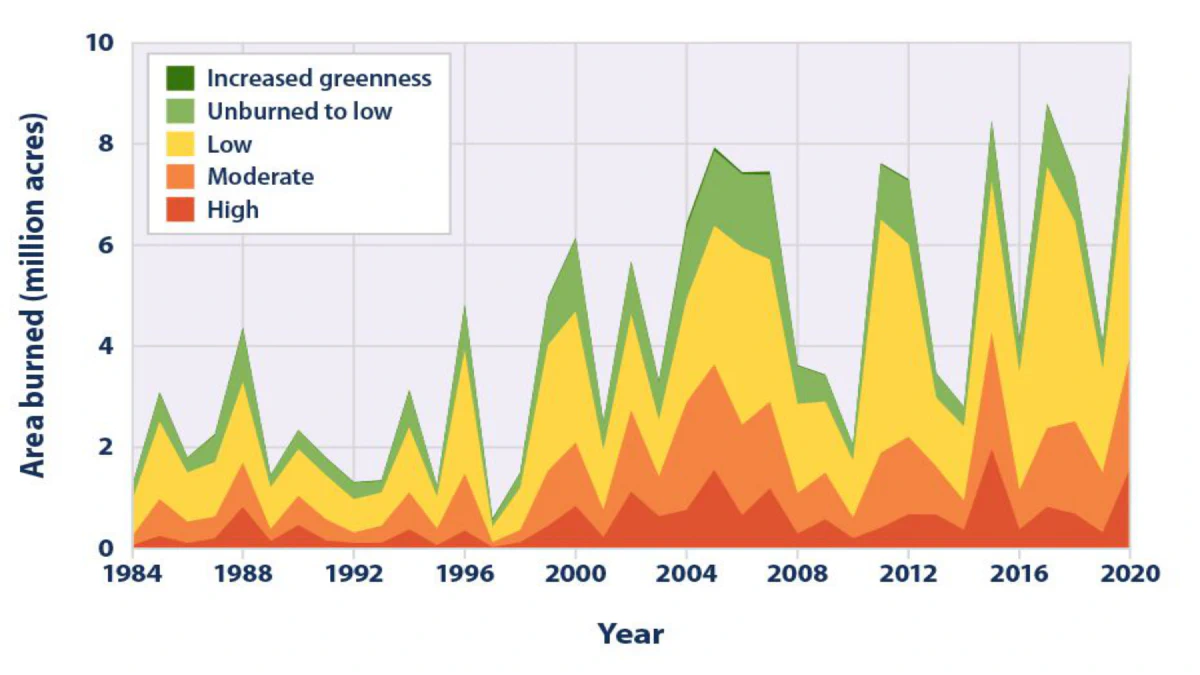
California alone lost $145 billion in GDP during the 2018 wildfires which would pay for the entire system almost 50 times over .
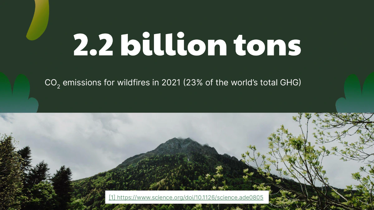
Not to mention, the amount of emissions from wildfires is on track to wipe out any gains humanity has made at reducing its carbon footprint.
A recent study showed that the 2023 wildfires in Canada released 1 gigaton of CO2. Canada as a whole only releases 0.67 gigatons of equivalent CO2 emissions per year. Across the globe, wildfires across the world have emitted 2.2 gigatons which is equal to 22% of the human made greenhouse gas emissions.
There is a significant caveat. Even if we could stop all wildfires within the United States, it is not a legitimate solution. Climate depends on wildfires renewing forests. But controlled burns are something that humanity is generally good at, so we can assume that with proper forest management, forests can still get the benefits of wildfires without emitting too much CO2.
Future plans
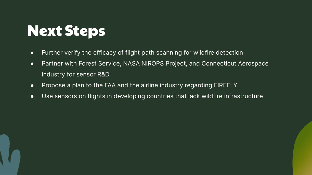
Currently we only visually demonstrate the effectiveness of planes equipped with our sensor. I hope to further validate the effectiveness of this idea through precise quantification of the times and distribution of flights over any given area of the United States.
One potential use case of a distributed wildfire detection system could be in countries without dedicated infrastructure for fighting wildfires, but are at trisk and have a high fly-over rate (Greece may be a candidate). This is something that I hope to look into in the future.
The problem with hackathons
After participating in a few hackathons, I am starting to realize their limitations. As an educational experience, hackathons provide a lot of value. However I think they give the false impression that this is how solutions to big problems are actually developed, especially when it comes to a huge problem like climate change. The trap of “inventing a solution for a problem that doesn’t exist” is a problem I find myself falling into quite often.
I want to acknowledge that this project, while it seems like a good idea, may not actually be the best solutions for addressing wildfires. To address climate change requires working with communities that are directly impacted and understanding what they need, versus what an engineer wants to build. Building solutions without consulting communities is one of the ways that we got into this climate mess.
While I still plan to attend hackathons, I think longer term competitions are much better suited to creating solutions that actually make a difference. It allows for deliberation in a project’s problem statement and research. Additionally, you aren’t necessarily constrained by resources available to you on the spot.
Firefly
Inducted November 12, 2023
Providing early detection of wildfires by using commercial airplanes as infrared aerial monitors. Won 2nd place at Hack4Delta 2023.